


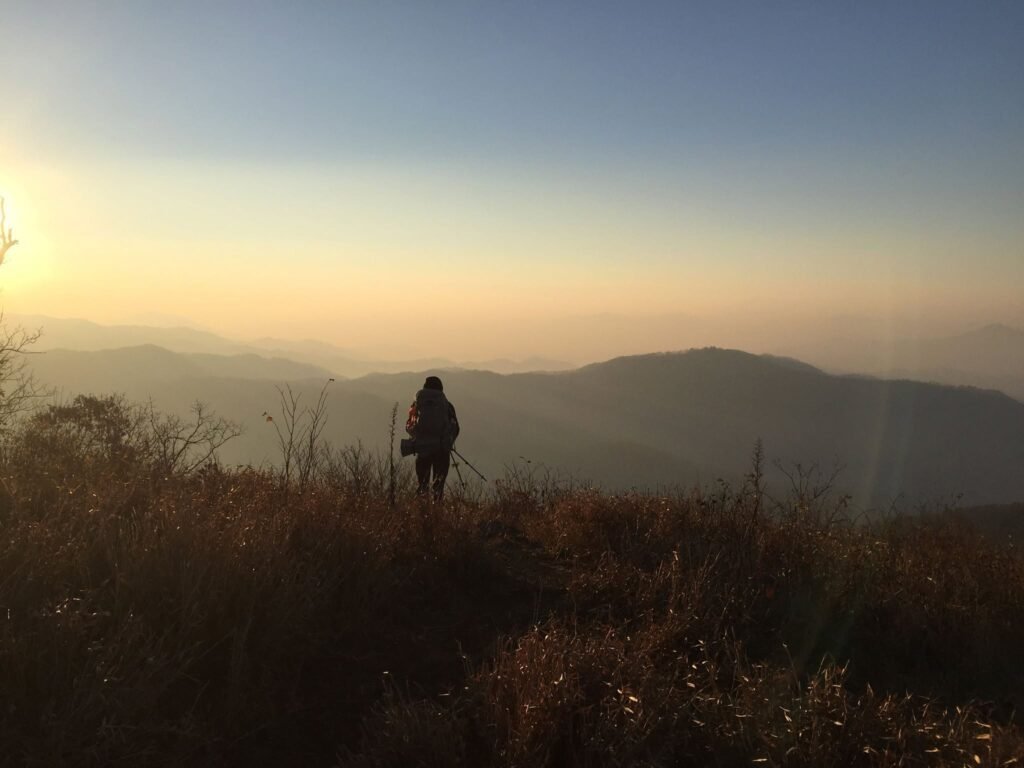
Georgia's Wild Beginning
A road trip guide from Amicalola Falls to the North Carolina line — where to stop, where to stretch your legs, and the history hiding in every gap.
SPRINGER MOUNTAIN * FANNIN & GILMER COUNTY* DAHOLONEGA, GA
78.6
AT Miles in GA
1937
TRAIL COMPLETED
4.458′
BLOOD MTN ELEVATION
4784′
BRASSTOWN BALD, GA HIGHEST POINT
This is where it all begins — at the foot of Springer Mountain, southern terminus of the 2,190-mile Appalachian Trail. Over this series, we’re driving the whole thing, state by state, pulling over wherever the road meets the white blazes to hike a little, learn some history, and see what the trail has to teach us. Georgia’s first. Fourteen states to go.

You don’t have to strap on a 40-pound pack and disappear into the woods for six months to touch the Appalachian Trail. You can do it from the driver’s seat, with the windows down and a thermos of coffee sweating on the console. Georgia’s stretch of the AT — just 78 miles of a 2,190-mile footpath — is the most drivable, most story-rich section of the whole trail, and it’s an easy weekend loop out of the Atlanta foothills. This is the route I’d point you toward: where the pavement runs close enough to the white blazes that you can pull over, lace up, and walk a little piece of something enormous.
"A journey of a thousand miles begins with a single step" gets quoted at every trailhead sign in Georgia — but the real story is that this whole trail began as a single idea, sketched by a forester who never lived to see it fully built.
THE BENTON MACKAYE STORY

The Trail That Almost Wasn't
The Appalachian Trail was the brainchild of Benton MacKaye, a Massachusetts forester and regional planner who in 1921 proposed a wilderness footpath running the length of the Appalachian range — not as a hiking trail so much as a chain of work camps and farm communities where city dwellers could escape industrial life. Volunteers, not the government, built it, mile by mile, over the next sixteen years. It was declared complete in 1937. The southern terminus originally sat atop Mount Oglethorpe, about 20 miles southwest of where the trail starts today — but by 1958, encroaching development and a badly eroded access road forced the Georgia Appalachian Trail Club to relocate the official start north to the quieter, more protected summit of Springer Mountain, where it remains.
Know Before You Go:
White rectangular blazes mark the Appalachian Trail itself; blue blazes mark side trails, shelters, and water access. If you get out to hike any section on this route, that’s the code the whole trail speaks.
Amicalola Falls State Park - Dawsonville, GA
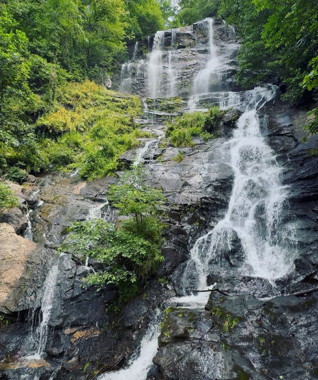
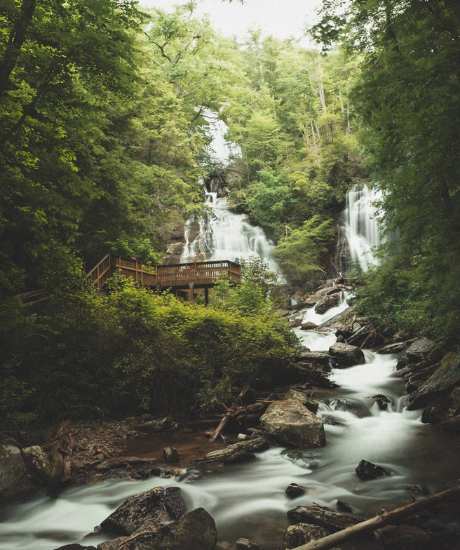
Start here, even if you never plan to hike a step. Amicalola Falls is Georgia’s tallest waterfall, tumbling 729 feet down a cascading rock face, and the state park built around it is the traditional launching point for northbound thru-hikers. Walk up behind the visitor center and you’ll find the stone Approach Trail arch — the spot where thousands of hopeful hikers each spring take their first photo before disappearing into the woods for months. That 8.8-mile Approach Trail was actually part of the original AT itself until the 1958 relocation, which is why old-timers still consider it the true beginning, blue blazes and all.

Get Out and Walk
You don’t need the full Approach Trail. The paved and staircase route along the falls itself is a short, dramatic walk with overlook platforms at multiple heights — doable in tennis shoes with kids in tow. For something longer, the Len Foote Hike Inn Trail shares the first stretch with the Approach Trail before splitting off.
Springer Mountain
Mile 8.8 (via forest road) · Chattahoochee National Forest
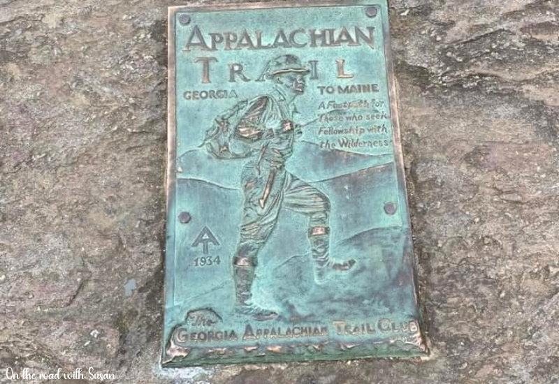
This is it — the true southern terminus, and it’s stubbornly hard to reach by car, which is part of its charm. Forest Service Road 42 gets you to a parking area about a mile shy of the summit; from there it’s a walkable stretch of the actual AT, white blazes and all, to the top. At the summit you’ll find a bronze plaque bearing the Appalachian Trail emblem, a metal box where hikers sign the trail register for the very first time, and — if you go in spring — a strong chance of meeting someone about to begin the hike of their life.
Driving Note
The forest service roads back to Springer are gravel, rutted, and genuinely rough — allow 30-45 minutes from GA 52, and skip it after heavy rain unless your vehicle has real clearance. Most travelers find it easier to simply hike the last mile in from the FS-42 parking area.
Woody Gap
GA Highway 60 · Lumpkin County
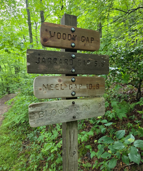
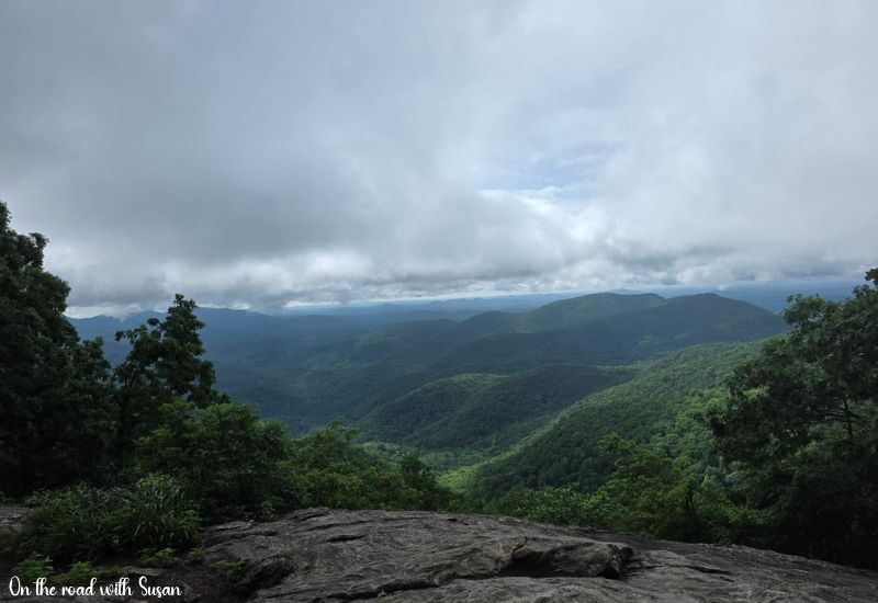
Georgia 60 is one of the loveliest stretches of pavement in the North Georgia mountains, and Woody Gap is where it crosses the AT directly — meaning you can pull into the parking area, step onto the white-blazed trail, and honestly say you’ve hiked the Appalachian Trail, even if it’s only for a quarter mile. This stretch of road also runs near the site of Georgia’s first documented gold strike, decades before anyone had heard of California’s rush.
Suches, Georgia
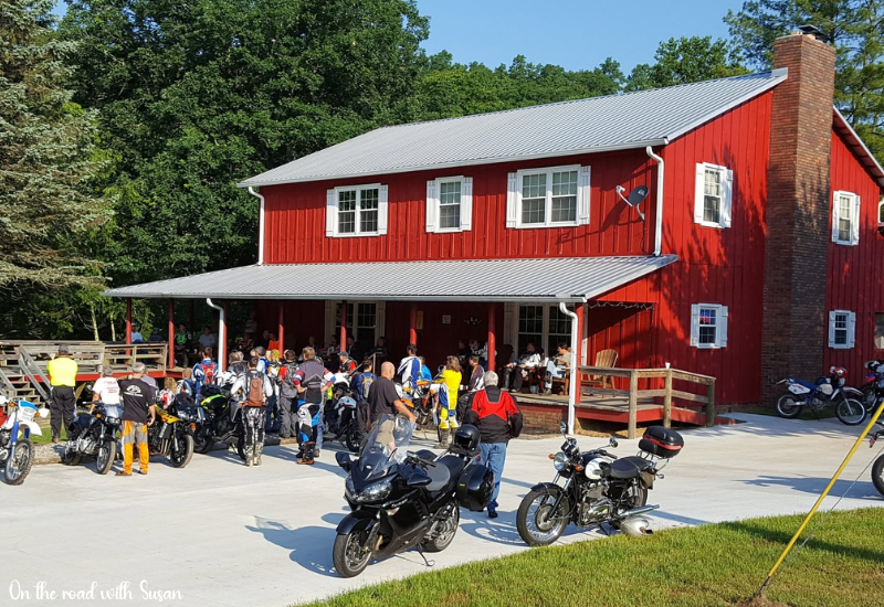
Just north on GA 60, the tiny community of Suches sits in a high mountain valley locals half-jokingly call the “Kickback Capital of Georgia.” It’s your best bet for a slow lunch and gas before climbing back into the mountains — there isn’t much else between here and Blairsville.
Neel Gap & the Walasi-Yi Center
US Highway 19/129 · Blairsville
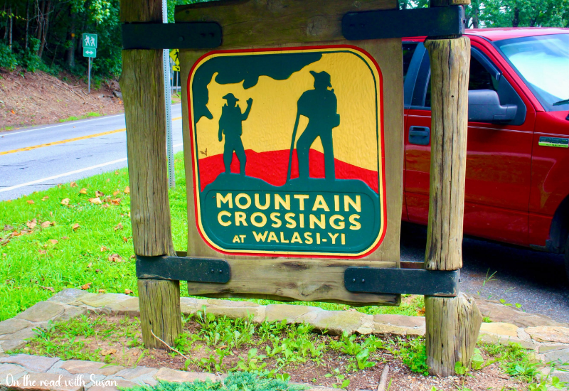
Of every stop on this drive, this is the one to slow down for. The Walasi-Yi Center is a stone building constructed between 1934 and 1938 by the Civilian Conservation Corps, and it holds a distinction found nowhere else on the entire 2,190-mile trail: the Appalachian Trail passes directly through its breezeway, the only man-made structure the AT physically runs through. It’s listed on the National Register of Historic Places, and today it operates as an outfitter and gift shop — famously the spot where discouraged hikers, just 30 miles into their thru-hike, sometimes throw their boots up into the trees lining the breezeway and call it quits.
Cherokee tradition held that Blood Mountain, rising just above the gap, was home to the Nunnehi — the "People Who Live Anywhere" — spirit people said to guide lost travelers safely back to the trail.
Get Out and Walk
The Neel Gap to Blood Mountain hike climbs steeply but steadily to Georgia’s highest point directly on the AT, with a stone shelter and sweeping views at the summit — on a clear day you can pick out four states.
Vogel State Park
GA Highway 19/129 · Blairsville
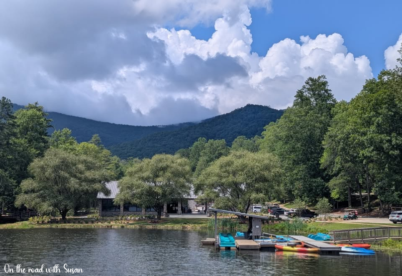
One of Georgia’s oldest and most-loved state parks, Vogel sits at the base of Blood Mountain and was itself shaped by CCC labor in the 1930s. It’s an easy detour off the AT corridor but worth the stop for Lake Trahlyta, the cottages, and a genuinely lovely short hike.
Get Out and Walk
The Bear Hair Gap Loop is an approachable 4-mile trail that passes Trahlyta Falls — a gentle way to stretch your legs without committing to the AT’s steeper grades.
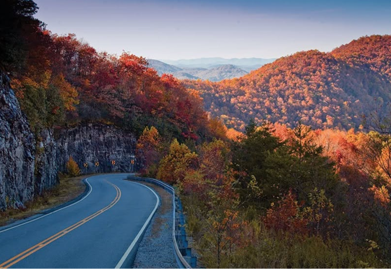
Richard Russell Scenic Highway & Brasstown Bald
GA Highway 348 · Union County
This designated scenic byway climbs through Unicoi Gap and Jack’s Gap on its way toward Brasstown Bald, Georgia’s highest natural point at 4,784 feet. A side trail from the AT at Chattahoochee Gap actually leads hikers up to the Bald’s summit, but you can drive most of the way and take a short walk (or a summer shuttle) up to the observation tower, where on a clear day the view stretches across Georgia, Tennessee, North Carolina, and South Carolina all at once.
Unicoi Gap & Helen, Georgia
GA Highway 17/75
The AT crosses the road again at Unicoi Gap, between Tray Mountain and Rocky Mountain, before the highway descends into Helen — Georgia’s Bavarian-themed alpine village, built up in the 1960s to resemble a German mountain town. It’s a strange and delightful contrast to walk out of true Appalachian wilderness and into half-timbered storefronts within the same afternoon, and it makes a good overnight base with plenty of lodging.
Dahlonega
A Worthwhile Detour · Lumpkin County
Loop back through Dahlonega before you finish, even though it sits south of the trail corridor — this is where America’s first major gold rush broke out in 1828, a full twenty years before the more famous rush in California. “There’s gold in them thar hills” was reportedly first said right here. The Dahlonega Gold Museum, housed in the old county courthouse on the town square, tells that story, and it ties directly into why this stretch of the mountains was surveyed, settled, and eventually threaded with the roads you’ve just been driving.

Bly Gap
Georgia/North Carolina Line
If you drive all the way to the state line, Bly Gap marks the northern edge of Georgia’s Appalachian Trail — 78.6 trail miles behind you, marked by a gnarled, wind-bent oak tree that’s become an unofficial trail landmark. It’s the natural place to end this particular drive, with North Carolina’s Nantahala section waiting for another trip.
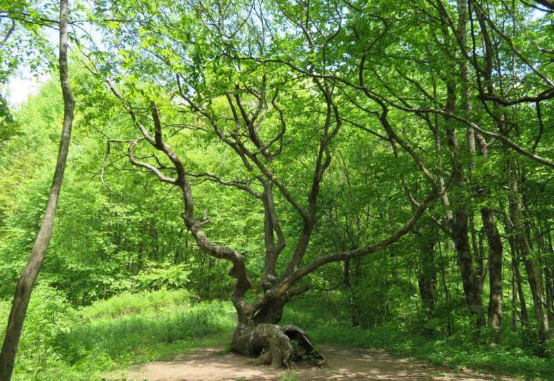
The Appalachian Trail exits Georgia and enters North Carolina at Bly Gap. There’s an oak near the A.T. close to the state line that has become somewhat legendary and is known by hikers as the “Boundary Tree.” It lies low, twists and turns before finally reaching up. It actually lies a little over 1,000 feet into North Carolina. The tree has probably stood there long before the A.T. began to pass it by, so if it could talk, it could tell a lot of stories. An acquaintance of the GATC maintainer for the northernmost section in Georgia once lived in the area and has recalled that before the area became a part of the Nantahala National Forest, the area was used by free-ranging cattle that would wander up from the valley below.
Planning the Drive
- Best season: Fall for color along the Blue Ridge, or spring (March-April) if you want a chance at meeting northbound thru-hikers just beginning their journey
- Route length: Roughly 90 miles of driving point to point, easily stretched into a full weekend with stops.
- Base towns: Dahlonega, Blairsville, or Helen all make good overnight anchors.
- Pack for both worlds: Real shoes for the trail sections, cash for the small mountain diners that don’t take cards, and a paper map — cell service disappears fast in the gaps.
Bly Gap is where Georgia hands the trail off, but it’s far from the end of the road. Seventy-eight miles down, over two thousand still to go — and the drive is just getting started. Join us next time as we cross into North Carolina and Tennessee, chasing the white blazes through wilder ridges and higher ground.
Look for part two in this series of 6 when we explore roughly 300 trail miles though North Carolina and Tennessee portions of the Appalachian Trail.